ADVERTISEMENT

OT: Pittsburgh construction what if's

HailToPitt725

Head Coach
May 16, 2016
11,437
10,876
113
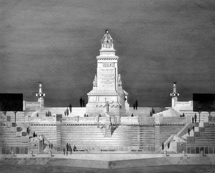
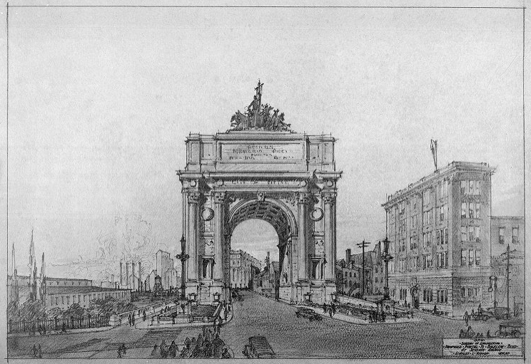
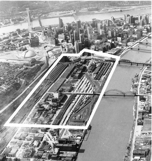
@TheSpecialSauce 's awesome post earlier this morning about the initial Forbes Field replacement over the Monongahela River got me thinking about other construction proposals that, for whatever reason, failed to materialize.

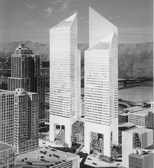
The Point State Civic Center was proposed on the land that is today Point State Park in 1947 by Frank Lloyd Wright as Pittsburgh began its post-war urban Renaissance. It was to house an opera house, sports arena, three movie theaters, an aquarium and planetarium, and a convention hall that was all wrapped by a spiraling strip of road. At the confluence of the three rivers would be a 500-ft skyscraper. The plan expressed Wright's interest in bringing the automobile into the social setting. If this had been built, Civic Arena is likely never constructed in the Lower Hill District due to the Civic Center housing both an opera house and a sports arena.
civic-center-persp-plan.jpg


Speaking of the Lower Hill, the Civic Arena wasn't supposed to be the only structure built as part of urban renewal in the Hill District. A Center for the Arts was to be built that would've housed an art museum (relocated from Oakland) and a new symphony hall. The design team behind the proposal addressed the sloping site by designing an enormous plinth with the art museum and the symphony hall at opposite ends of a landscaped plaza, affording dramatic views. The symphony hall was to be wrapped in a monumental glass box and flanked by oversize travertine columns supporting a waffle-slab roof. The three-story art museum was to be enlivened with a crenelated roof structure. Between this and Wright's monstrous design, we would've had quite the cultural institutions.
f15-hac-4.jpg


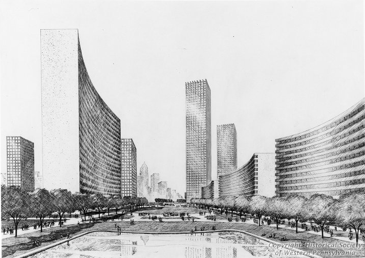
One other plan was a Panther Hollow development that was to help expand the University's campus. The architect appointed by Pitt proposed a structure to fill the entire ravine straddling Pitt, the Carnegie Museums and Carnegie Mellon University. Envisioned as a research city linking Oakland’s academic and cultural institutions, the mile-long complex would have filled the hollow to the brim, expanding Schenley Park with a series of rooftop terraces and gardens and culminating in a hanging garden at Panther Hollow Lake.
litchfield-3-1.jpg

litchfield-5.jpg


I know that the University had several different campus master plans throughout the 20th century that've been touched on here before, including the Greek-inspired Acropolis plan and the original Cathedral of Learning design that would've taken up the entire lawn (I have the blueprints somewhere but can't find the book). There was also a very ambitious Lower Hill redevelopment plan designed by the Bjarke Ingels Group about ten years ago that obviously fell through. Are there any other big ones that I'm missing?
 
I remember seeing a model or rendering, I think it was in connection with the Civic Arena and/or the other proposed arts center buildings for the lower hill that is included in this thread, that showed a redevelopment extending waaaaaay up into the rest of the hill. Huge high rises for blocks, I presume they were office buildings or tower apartments. Obviously, Pittsburgh never grew large enough to accomodate such a massively sprawling urban center, but it was like someone envisioned Downtown plus a large portion of the Hill District essentially becoming Manhattan.
 
  • Like
Reactions: HailToPitt725
That Panther Hollow plan is a mid-century fever dream. It’s wild what folks were cooking up in that period of urban planning - they’d just let you build a big model of whatever you could think of after you spent an hour or two licking the lead paint off the walls.
 
  • Like
Reactions: HailToPitt725
Can't imagine Point State Park being filled with that giant building. That would have been horrendous. The green space there is nice.
 
  • Like
Reactions: NNFAN
They could still do something with Panther Hollow that is much less invasive on the environment. Starting with an electric vehicle road that links Pitt and Oakland with the new developments on Hazelwood Green.
 
  • Like
Reactions: HailToPitt725
I remember seeing a model or rendering, I think it was in connection with the Civic Arena and/or the other proposed arts center buildings for the lower hill that is included in this thread, that showed a redevelopment extending waaaaaay up into the rest of the hill. Huge high rises for blocks, I presume they were office buildings or tower apartments. Obviously, Pittsburgh never grew large enough to accomodate such a massively sprawling urban center, but it was like someone envisioned Downtown plus a large portion of the Hill District essentially becoming Manhattan.
I think what you’re referring to is this plan, the much larger Lower Hill Cultural Center. It was a massive plan that would've actually incorporated a lot of green space (and concrete). Had this gone through, along with some of the other projects mentioned, Pittsburgh would've become the brutalist capital of the world. When you see this, it begins to make more sense why they cleared so much land for the Civic Arena construction. I’m unsure how far it was supposed to go back into the Hill District. Also, notice how the highway was already capped in the original plan, something that didn’t happen until very recently.
original.jpg
 
Last edited:
They could still do something with Panther Hollow that is much less invasive on the environment. Starting with an electric vehicle road that links Pitt and Oakland with the new developments on Hazelwood Green.
Bill Peduto’s electric tram project was rightfully sent to the dustbin of history when Ed Gainey took office.

Working with the Port Authority (I know they’re called something different now) to expand actual transit options from Oakland to Hazelwood? That’s something that I think a lot of people could get behind. The private electric tram through the park was opposed by almost everyone outside of the mayor’s office and whoever was going to profit off of the deal.
 
The Panther Hollow initiative or something like it should have happened. Lot of wasted land there
They could still do something with Panther Hollow that is much less invasive on the environment. Starting with an electric vehicle road that links Pitt and Oakland with the new developments on Hazelwood Green.
The Panther Hollow plan is fascinating in a couple different ways. The way they billed it was that it would be a "horizontal skyscraper." Notice all the cars and trains that would've still ran underneath the project... had development shifted that way, perhaps we would've gotten a subway from Oakland to downtown or elsewhere at some point.

It, like the Frank Lloyd Wright proposal, was almost pro-city yet anti-urban in a way. These projects went against the grain at the time by being placed in urban areas versus suburbs, yet are very pro-car in their development.
 
  • Like
Reactions: imrealangry
This also isn't a real development plan or whatever, but I always liked this. A couple of years ago, a senior design team from the Civil Engineering department decided to conceptualize an on-campus football stadium for Pitt. They proposed putting it where the OC Lot and Cost Center are now, next to Sutherland, complete with a view of the Cathedral out of the south end zone. Would also link all the other athletic buildings on campus (Pete, Ambrose, new T&F facility).

All their files can be found here. It's a little amateur because it was done by students, but it's a fun read nonetheless.

New Pitt Stadium Senior Design Project
 
  • Like
Reactions: HailToPitt725
Bill Peduto’s electric tram project was rightfully sent to the dustbin of history when Ed Gainey took office.

Working with the Port Authority (I know they’re called something different now) to expand actual transit options from Oakland to Hazelwood? That’s something that I think a lot of people could get behind. The private electric tram through the park was opposed by almost everyone outside of the mayor’s office and whoever was going to profit off of the deal.
Oh god, that silly little "microtransit" idea was a real piece of shit. The BRT plan they're implementing for Fifth and Forbes now actually is a great idea and I can't wait to see it implemented. Part of one of my senior classes was dedicated to running the numbers on bus ride trips along that corridor, I think it will greatly help out.

However, if PGH were to connect Oakland and Hazelwood, it should be a formal transit solution, not some Uber bastardization of what we know works.
 
  • Like
Reactions: pittchagg
Also, here's a few more "what ifs" that I stumbled upon through the Pittsburgh Magazine.

Pittsburgh had two proposals in the early 1900s that fell through. One was a gigantic statue of William Penn that would've been placed where Point State Park is today. The other was a large arch that was to be an entrance to Bigelow Boulevard if you were coming from Seventh St downtown.
Screen20Shot202014-01-1720at201025320PM.png

Screen20Shot202014-01-1720at201060420PM.png


There was also a few skyscraper projects that fell through over the course of the 20th century. The first was the "Mall of Penn Park" that would've razed the Strip District between 10th St and 21 St running up to Bigelow. It was to be an "extension of the Golden Triangle."
Screen20Shot202014-01-1720at201040320PM.png

Screen20Shot202014-01-1720at201043620PM.png


12 years later, the Grant Plaza was proposed in 1978 that would've given Pittsburgh its equivalent of the Twin Towers. It was to be built Grant and Smithfield St. It looks like there also would've been an enclosed atrium connecting the towers on the ground level.
Screen20Shot202014-01-1720at201052920PM.png
 
Oh god, that silly little "microtransit" idea was a real piece of shit. The BRT plan they're implementing for Fifth and Forbes now actually is a great idea and I can't wait to see it implemented. Part of one of my senior classes was dedicated to running the numbers on bus ride trips along that corridor, I think it will greatly help out.

However, if PGH were to connect Oakland and Hazelwood, it should be a formal transit solution, not some Uber bastardization of what we know works.
I agree with you on both counts. But I’m someone who’s a big believer in the busway system and bus transportation generally, of which the BRT will be a big part. If I was King Of The Region, I’d tear up the T lines and replace them with busways (even underground, downtown, over to the North Shore), extend the West Busway to the airport, etc.

Without veering into the political, the microtransit project was…let’s just say an extremely “Bill Peduto” sort of plan. I think there’s a place for a transit solution that further connects Oakland with Hazelwood, but if you’re going to do a hard build, my preference would be in a dedicated mini-busway running along the railroad ROW through the hollow, through the run, and spitting you out at Hazelwood Green and into Hazelwood. Then you could tie it into the Neville Street ramp that connects you over to the East Busway and downtown/the greater east end.
I'm a fan of BRT if it's done right, instead of what it has recently become, which is a sort of half-measure done on the cheap. PGH's busways are world class and were done with such ambition that they still continue to be world class to this day.
 
Bill Peduto’s electric tram project was rightfully sent to the dustbin of history when Ed Gainey took office.

Working with the Port Authority (I know they’re called something different now) to expand actual transit options from Oakland to Hazelwood? That’s something that I think a lot of people could get behind. The private electric tram through the park was opposed by almost everyone outside of the mayor’s office and whoever was going to profit off of the deal.

The big problem with Peduto's plan was that it was to be a private road, which is stupid. Plus, it would have bypassed "The Run" neighborhood in Greenfield, cutting them off from having easy access to and from Oakland. Ideally, this would be a light rail extension from Oakland, but since the Steelers forced the North Shore Connector, we have to go with the bogus BRT, which is better than nothing but still $hit. So the plan should be to connect that BRT line to Hazlewood by way of the Panther Hollow connector, preferably with quiet electric vehicles and a stop in The Run.
 
I think the biggest "what if" for Pittsburgh's construction would have to be Skybus. Imagine how much better Pittsburgh traffic would be if you weren't forced onto 376 to get into the city from the East
This is another good one. Here's the original Skybus proposal that would've connected most of the city. One glaring exception would be the airport, though I'd imagine that would've eventually happened.
pittsbugh-skybus-67-for-the-article.png


Also, speaking of transit, Pittsburgh had a fortunate near-miss with a massive inner-city highway proposal that would've carved the city up like a turkey more than they already did. Fun fact: the Birmingham Bridge is the one part of the project that was actually built. All of the dead-end lanes were supposed to be connectors to a larger system going into the Mon Valley.
pgh1963.jpg
 
  • Like
Reactions: imrealangry
I agree with you on both counts. But I’m someone who’s a big believer in the busway system and bus transportation generally, of which the BRT will be a big part. If I was King Of The Region, I’d tear up the T lines and replace them with busways (even underground, downtown, over to the North Shore), extend the West Busway to the airport, etc.

LOL. You cra!
 
This is another good one. Here's the original Skybus proposal that would've connected most of the city. One glaring exception would be the airport, though I'd imagine that would've eventually happened.
pittsbugh-skybus-67-for-the-article.png


Also, speaking of transit, Pittsburgh had a fortunate near-miss with a massive inner-city highway proposal that would've carved the city up like a turkey more than they already did. Fun fact: the Birmingham Bridge is the one part of the project that was actually built. All of the dead-end lanes were supposed to be connectors to a larger system going into the Mon Valley.
pgh1963.jpg
Those planned skybus lines are awesome. PRT is even now looking into creating extensions and transit corridors decades later because they knew what they were doing back then!

Always wondered what those stubs were on the birmingham. Don't speak too early about PGH being saved from expressway construction - they seem to be really serious about finishing 579 around the city and bringing 43 up from the south :confused:
 
  • Like
Reactions: HailToPitt725
The Panther Hollow plan is fascinating in a couple different ways. The way they billed it was that it would be a "horizontal skyscraper." Notice all the cars and trains that would've still ran underneath the project... had development shifted that way, perhaps we would've gotten a subway from Oakland to downtown or elsewhere at some point.

It, like the Frank Lloyd Wright proposal, was almost pro-city yet anti-urban in a way. These projects went against the grain at the time by being placed in urban areas versus suburbs, yet are very pro-car in their development.

The car centric ideas seem more and more terrible every time I see them. Imagine a giant mega building with cars driving around it? Good God.

The Europeans have it right. Make urban neighborhooods as people and bike friendly as possible. Urban environments are better when designed for PEOPLE, and not cars. Of course we need to roads, too, but we don't need them to be a central to all development. Mixed used zoning without building highrises seems to be better too.
No parking minimums for buildings either over there, which turned America's great downtowns into bland asphalt lots
 
The car centric ideas seem more and more terrible every time I see them. Imagine a giant mega building with cars driving around it? Good God.

The Europeans have it right. Make urban neighborhooods as people and bike friendly as possible. Urban environments are better when designed for PEOPLE, and not cars. Of course we need to roads, too, but we don't need them to be a central to all development. Mixed used zoning without building highrises seems to be better too.
You're preaching to the choir on that one. A lot of cities are beginning to realize the mistakes made in the post-war urban renewal era.
 
  • Like
Reactions: imrealangry
You're preaching to the choir on that one. A lot of cities are beginning to realize the mistakes made in the post-war urban renewal era.

True, but I just don't have a whole lotta faith that we can get it done any time soon. It's depressing, actually. Can't even build a bike lane without people bitching up a storm, and most of them are living in the burbs.
 
I know it’s bold, that’s why I’d need to have unfettered authority in order to do it!

I'm glad you don't :cool:

I'd build more dedicated trasnit lines, linking Downtown to Oakland and the East End. Link the Oakland line over to Hazlewood, across the river to the Southside, then through the SS to Station Square and back over to Downtown. That would be a very nice central loop of sorts. Then extend a line to Sandcastle and Kennywood, linking that area and spurring more development.

They also don't need stops every 5 feet.
 
  • Like
Reactions: imrealangry
I'm glad you don't :cool:

I'd build more dedicated trasnit lines, linking Downtown to Oakland and the East End. Link the Oakland line over to Hazlewood, across the river to the Southside, then through the SS to Station Square and back over to Downtown. That would be a very nice central loop of sorts. Then extend a line to Sandcastle and Kennywood, linking that area and spurring more development.

They also don't need stops every 5 feet.
So basically, we need the Spine Line proposal.
18x24+Poster.jpg
 
  • Like
Reactions: imrealangry
I'm glad you don't :cool:

I'd build more dedicated trasnit lines, linking Downtown to Oakland and the East End. Link the Oakland line over to Hazlewood, across the river to the Southside, then through the SS to Station Square and back over to Downtown. That would be a very nice central loop of sorts. Then extend a line to Sandcastle and Kennywood, linking that area and spurring more development.

They also don't need stops every 5 feet.
Feels like the best way to get out towards Kennywood, though, is through the East Busway, which is right across the river and has already done 80% of the work for you.

The South Side is a tough nut to crack, and I don’t really know how to figure it out. Unless one of those two main rail lines that kind of border the neighborhood are abandoned (which they won’t be) there isn’t really a great right of way that’s separated from Carson Street. They’ve tried the loop routes in the past and they haven’t really gotten a ton of ridership. The other option would be something that hums through the south side on the way to the southern hilltop neighborhoods that aren’t serviced by the brown line, before you end up getting spit out past Carrick at the south busway near the 51/88 split. The issue there is that massive transit investments are usually made to accelerate growth in already-growing areas, and that part of the south hills is just not that.
 
So basically, we need the Spine Line proposal.
18x24+Poster.jpg
I've always loved how this map combines the thought of lines that spoke outwards from downtown, but also are routed radially around the city. What all modern networks should be striving for & what NYC is attempting to do with the triboro Rx line on abandoned freight ROWs.
Feels like the best way to get out towards Kennywood, though, is through the East Busway, which is right across the river and has already done 80% of the work for you.

The South Side is a tough nut to crack, and I don’t really know how to figure it out. Unless one of those two main rail lines that kind of border the neighborhood are abandoned (which they won’t be) there isn’t really a great right of way that’s separated from Carson Street. They’ve tried the loop routes in the past and they haven’t really gotten a ton of ridership. The other option would be something that hums through the south side on the way to the southern hilltop neighborhoods that aren’t serviced by the brown line, before you end up getting spit out past Carrick at the south busway near the 51/88 split. The issue there is that massive transit investments are usually made to accelerate growth in already-growing areas, and that part of the south hills is just not that.
Yeah, there's no chance CSX or NS are abandoning those lines anytime soon, so let's get bold: transform the alleyways into surface running light rail.
 
Feels like the best way to get out towards Kennywood, though, is through the East Busway, which is right across the river and has already done 80% of the work for you.

The South Side is a tough nut to crack, and I don’t really know how to figure it out. Unless one of those two main rail lines that kind of border the neighborhood are abandoned (which they won’t be) there isn’t really a great right of way that’s separated from Carson Street. They’ve tried the loop routes in the past and they haven’t really gotten a ton of ridership. The other option would be something that hums through the south side on the way to the southern hilltop neighborhoods that aren’t serviced by the brown line, before you end up getting spit out past Carrick at the south busway near the 51/88 split. The issue there is that massive transit investments are usually made to accelerate growth in already-growing areas, and that part of the south hills is just not that.

Then use Carson St!
 
Anyone else wonder at what Frank Lloyd Wright might have achieved if he access to MSPaint?
I’m just glad we learned who was responsible for the ‘New Pitt Stadium’ push. Here I was thinking it was some middle-aged superfan with too much time (and billboard money) on their hands! :oops:
 
  • Like
Reactions: pittdan77
I think the biggest "what if" for Pittsburgh's construction would have to be Skybus. Imagine how much better Pittsburgh traffic would be if you weren't forced onto 376 to get into the city from the East
Except Skybus wasn't planned to serve the east. It was planned to serve the South Hills. (That was why County taxpayers rebelled. It would have been one leg of a countywide plan, but instead of explaining and emphasizing that plan, the dufus county commissioners focused on "Skybus, Skybus, Skybus".)
 
  • Like
Reactions: imrealangry
ADVERTISEMENT
ADVERTISEMENT